|
Socorro to Escondida Bridge |
 |
|
|
Socorro to Escondida Bridge |
|
|
|
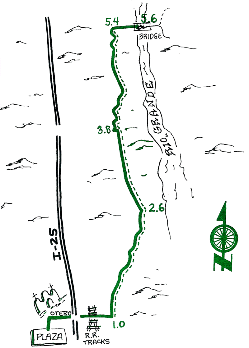
This is one of the most straight-forward paths to the Bridge, which serves as the starting point for several other rides. You might choose this route if you will take one of the rides that starts at the Bridge and heads east (see BARITE MINE, CERRILLOS DEL COYOTE, etc.).
| Mileage | Surface | Notes |
|---|---|---|
| 0.0 | PAVED | Starting at the Plaza, go east on Manzanares and turn left onto California Street at the traffic light. At the next light turn right onto Otero, go under I-25, over the RR tracks, and continue straight as the road turns to dirt. |
| 1.0 | DIRT | Turn north (left) onto the first ditch road that you come to |
| 2.6 | DIRT | ...end of Jaral Ditch; continue north (left) on the west bank of this larger ditch. |
| 3.8 | DIRT | Go up the hill, over the bridge, bear slightly right, and continue north with the ditch on your right and fields to your left. |
| 5.4 | PAVED | Turn right onto the paved road. The road climbs slightly to cross over a Low-Flow Channel before you reach |
| 5.6 | PAVED | ...the Escondida Bridge over the mighty Rio Grande (which appears less than majestic at the end of a dry summer when all the water is diverted into the system of irrigation ditches along the valley). |