|
Cerrillos del Coyote |
 |
|
|
Cerrillos del Coyote |
|
|
|
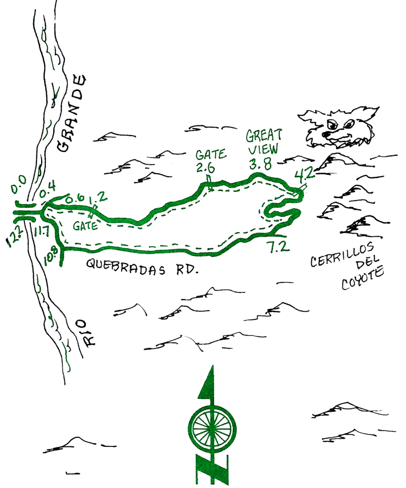
This ride features great views and beautiful country east of the Rio Grande. In hot weather, go early in the morning or in the evening. Take sunscreen, a snack, and plenty of water.
| Mileage | Surface | Notes |
|---|---|---|
| 0.0 | PAVED | (If you biked to the Bridge. reset your odometer or adjust the following mileages.) From Escondida Bridge across the Rio Grande, head east. |
| 0.4 | DIRT | At the "I" intersection, turn left (north) onto the dirt road. |
| 0.6 | DIRT | Turn right just past the cattle guard on the north side of the property and house, onto a small track. |
| 1.2 | DIRT | Gate. Close it after you. |
| 2.6 | DIRT | Another gate. Close it also. |
| 3.8 | DIRT | The view from the hilltop is great. To the east are the Coyote Hills, where you will soon be. |
| 4.2 | DIRT | Gate. Continue east and south into and across a mine area. After the mine, follow the track west and down across the arroyo and up the other side. |
| 6.7 | DIRT | The road gets better now. |
| 7.2 | DIRT | Join the Quebradas Road and go right (west) and downhill. |
| 10.8 | DIRT | At the junction, turn right (north). |
| 11.7 | PAVED | Pavement; stay on it, and head back toward the river. |
| 12.2 | PAVED | Escondida Bridge. |