|
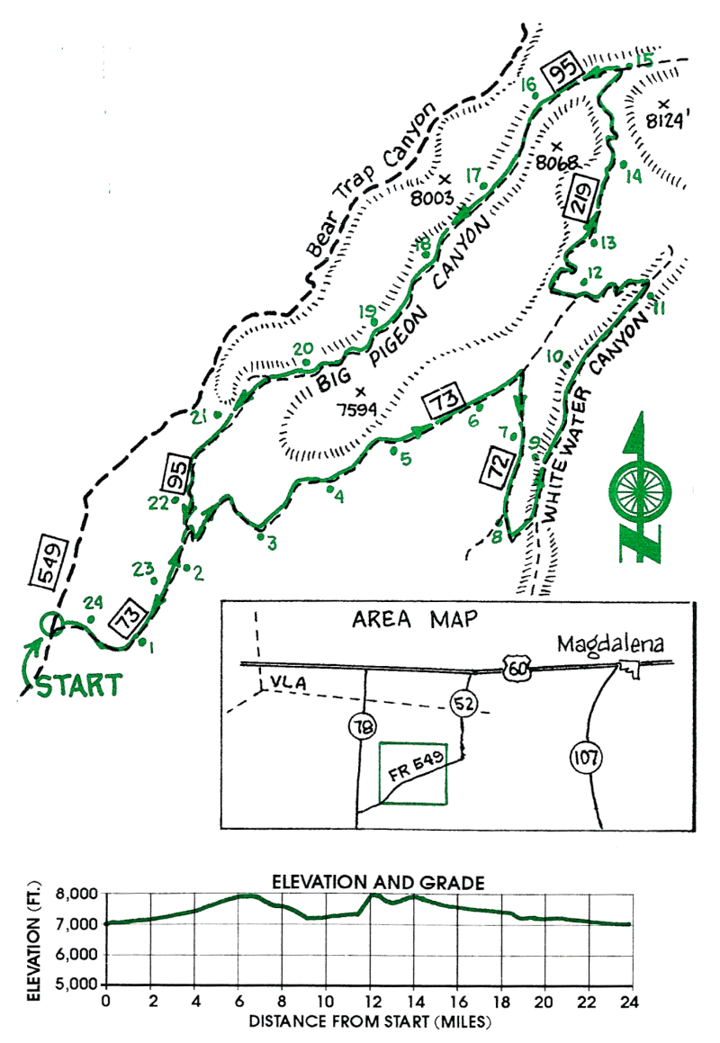
White Water and Big Pigeon Canyons |
 |
|
|
White Water and Big Pigeon Canyons |
|
|
|
This ride is through pinion and ponderosa pine forest and grassy meadows in the northern San Mateo mountains. The highlights of the ride are the beautiful Whitewater and Big Pigeon Canyons. The riding is mostly on reasonable forest roads with some difficult stretches in Big Pigeon Canyon where the trail frequently crosses the rocky streambed which may be flowing in the spring and early summer.
| Mileage | Surface | Notes |
|---|---|---|
| 0.0 | DIRT | Junction of FR 549 and FR 73. Ride east on FR 73. |
| 2.2 | DIRT | Junction with FR 95 on left. This is your return route out of Big Pigeon Canyon. Continue east on FR 73 and climb steadily. |
| 5.2 | DIRT | Cattle guard across FR 73. |
| 6.4 | DIRT | Turn right (south) on FR 72. Do not turn off onto FR 72A. Soon turn east and descend into Whitewater Canyon. |
| 8.3 | DIRT | Turn left at the ruins of the log cabin and stone chimney and ride north up Whitewater Canyon on the old road which occasionally crosses the stream bed. The canyon floor is mostly flat grassy meadows with stands of ponderosa pine. |
| 11.1 | DIRT | Junction with FR 73. Turn left (west) on FR 73 and climb out of the canyon. |
| 12.1 | DIRT | Junction with FR 219. Ride west and north on FR 219 passing by Bitter Creek Tank. |
| 15.0 | DIRT | Big Pigeon Canyon. Turn left down the canyon on FR 219A. The road soon becomes rough and hard to follow in places with frequent crossings of the rocky streambed. There are a few stretches of difficult riding where the canyon narrows. In the spring and early summer the stream may be flowing. |
| 20.4 | DIRT | Mouth of Bear Ranch and windmill on the right. Continue on the road down the canyon. |
| 22.2 | DIRT | Junction with FR 73. Follow FR 73 back to your car. |
| 24.4 | DIRT | Junction of FR 73 with FR 549. |